ホーム > くらし・安全・環境 > 身近な生活 > 外国籍県民・多言語情報 > Kanagawa Updates & Photo Topics Top > Kanagawa Updates (May '25)
Main content starts here.
Kanagawa Updates (May '25)
Introducing the latest topics of Kanagawa and the prefectural government.
Kanagawa Updates & Photo Topics Top
Photo Topics
Dangerous Cliffs are Visually Recognized
3D Maps of Sediment Disaster Alert Areas Now Available
 Kanagawa Prefectural Government (K.P.G.) has designated dangerous cliffs and their surrounding areas as sediment disaster alert areas as a soft measure to prepare for disasters on a steep terrains, and made efforts to raise awareness among the residents. When heavy rain increases the level of danger, K.P.G. announces sediment disaster alert information in coordination with the meteorological agency and sends out emergency alert e-mails to encourage residents to evacuate appropriately.
However, landslides can occur even without heavy rain. It is important for residents to fully recognize the danger of cliffs at all times, and for land administrators to always keep maintaining the cliffs properly.
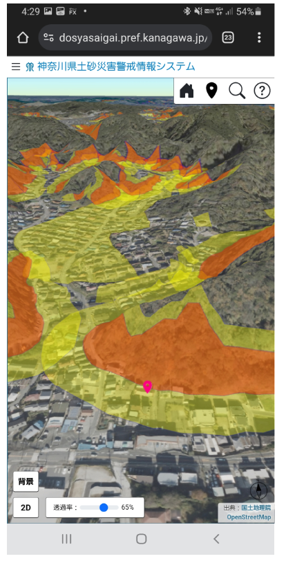
As one of the measures, K.P.G. created 3D maps of the sediment disaster alert areas based on the existing maps utilizing the 3D point cloud data* so that the danger level of the cliff areas could be visually recognized. The new maps are available on our website since April 1 this year.
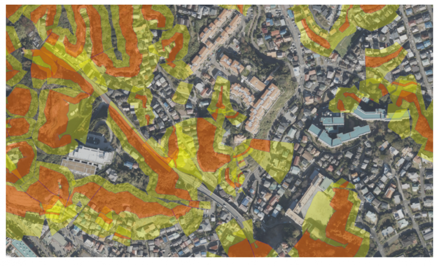
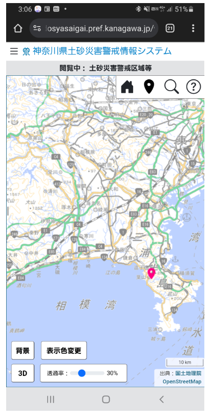
Prior to that, only the 2D maps of sediment disaster alert areas were posted on the website, indicating the danger levels by color coding. The yellow part indicates that the district has a risk of sediment disasters, and red indicates that the buildings in the area could be damaged and endanger the lives and safety of people in case of a disaster. 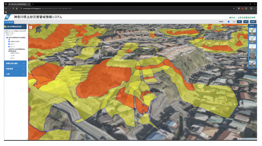
When the 2D maps are turned to 3D, the elevation of the cliffs near your home can be viewed from various angles. The maps can also be seen on mobile devices, making it easier for you to visibly recognize the danger level of where you are.
K.P.G. will hold briefings for real estate-related organizations on the dangers of cliffs and what to look out for when managing such areas, utilizing the 3D maps. We will also encourage land administrators to properly manage the land through these organizations, and make these maps widely known to the prefectural citizens to help prevent human damages from sediment disasters.
Kanagawa Prefecture sediment disaster information https://dosyasaigai.pref.kanagawa.jp/website/kanagawa/gis/index.html
*3D point cloud data: A group of points with location information of latitude, longitude, and height